Tuesday, August 20, 2013

The African Continent

Common map projections don't do justice to the enormity of the continent of Africa, the continent, that has 62 countries and one billion people.  There is, however, a map that does show just how big Africa is by inserting maps of large countries into the continent (all projected at the same scale).
Kai Krause's awesome map, originally found here
My PhD research is in the East African Rift System, which is ~6000km long. Although EARS is big, it is still a small part of the whole continent.  I'm working on more detailed blog posts about EARS and some of the research I've been involved in (including the field work I was recently a part of in Kenya), but first I want to provide a general overview of Africa (I've already posted about the African Great Lakes here)

The geological history of Africa is different from the other continents. For the last 200 million years Africa has been relatively stationary and has been nearly surrounded by oceans for the last 130 million years. From 183 to 133 million years ago a mantle plume (the Karroo plume) influenced African tectonics - at this time the West and Central African rift systems were active. Another plume is currently "active" beneath Africa - the Afar Plume. For the last 30 million years this plume has been influencing the development of the East African Rift System. In between the two plume episodes was a long period of relative tectonic quiescence where erosion dominated, forming what is known as "the African Surface."

Reference:
Burke, K., and Gunnell, Y., 2008, The African erosion surface: a continental-scale synthesis of geomorphology, tectonics, and environmental change over the past 180 million years: Geological Society of America Memoir, v. 201.

Tuesday, August 6, 2013

Clay day!

Months ago, on a field trip, I was discussing my research with one of the members of my committee. I mentioned I was thinking about incorporating some modeling into my work, and while I was thinking computers, he suggested clay.  Nothing fancy, just using clay to deform some layers in a "back of the envelope" kind of way.  I spent a lot of time thinking about it, especially as I've agonized over interpreting faults in my 2D seismic data. Would slicing a 3D model open at different angles help me figure out what things might look like in 2D?

Fast forward to this month, and I'm trying to get a preliminary version of a fault map done for my study area to go with a draft of my research proposal for my committee. I'm having a hard time committing to my interpretations (something I've struggled with since undergrad, when I always said I needed more data for my subsurface geology labs).  

Seismic is an amazing tool, but I love being a geologist because it is so tactile. I decided I needed clay.  It arrived today.  This just might replace colouring as one of my favourite things about being a geologist (although nothing will ever replace being in the field at the very top of the list).

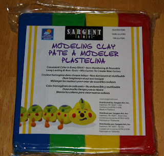
A new package of modeling clay!

I don't think I actually expected to solve my interpretation problems the first time I played with my clay, but after spending a bit of time working with it, I wasn't sure I was going to solve any problems with it.


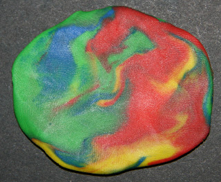
Using 2D imaging to look at a 3D world is a problem in geology, not only when you're looking at seismic, but often when you're looking at the face of an outcrop. It's easy to misunderstand what you're seeing because you're not seeing the whole picture. Something that looks like this from one angle:
One side of a smooshed ball of clay
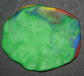
 looks like this from another angle:
The other side of the same smooshed ball of clay.