
This morning I downloaded the new data for the Lake Malawi region from the USGS Earth Explorer and created a new raster image. I use a technique posted in an ESRI blog to create pansharpened images. Essentially, this drapes the tinted elevation file over a hillshade, creating an image that shows relief without the need for making any layers transparent.
The image below compares the two datasets. The top image is the new SRTM data released yesterday and the bottom is the older, lower resolution data. The diagonal line drawn through the top middle is about 7.97km long. There are still a few gaps in the new 30 m DEMs, but on a regional scale, there are far fewer than in the 90 m DEMs. Look how crisp and detailed the shoreline is now.
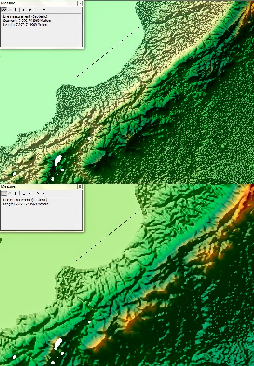 |
| Top: 30 m SRTM. Bottom: 90m SRTM. North at the top. Click to embiggen. |
Not only will my maps look better with the newer DEMs, it is easier to find the onshore border faults of the rift basin with the higher resolution data (hint: I'm pretty sure one runs right through this image, approximately parallel to, and southeast of, the line I drew for a scale reference).
Hey Tannis, Thanks for sharing this info. MC-AZ Geological Survey
ReplyDeleteCasino Slot Machines In New York City - JTM Hub
ReplyDeleteNew York's 광명 출장안마 first 안성 출장마사지 casino 충청남도 출장샵 to reopen its doors 블랙 잭 is the Tropicana Hotel Casino & Spa, which is open Friday through Saturday 김해 출장마사지 from 6:00 p.m. – 7: